

15 + 30 points
The Low Score Task by Crusher Joe
May 23rd, 2007 10:03 PM
Since I don't live in SF, I had to get a little creative...
...but I noticed that others had already taken two options for "taking a picture" when they didn't live in SF.
So I had to do a little thinking (which is the idea, right?)...and this is what I did:
1. Looked up the exact address of Sutro Tower on www.mountsutro.org (1 La Avanzada Street, San Francisco, California 94131-1124 a/k/a 250 Palo Alto Avenue, San Francisco, California 94114-2123).
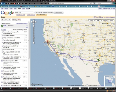
2. Used Google Maps to determine just where Sutro Tower is in relationship to where I am (as well as the distance, which is 1759 miles) (see attached screenshot).
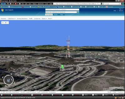
3. Used MS Virtual Earth to get a 3D image of Sutro Tower, with the orientation set correctly as if I were viewing the tower from my home (albeit at a much closer range than 1759 miles). (see attached screenshot)
...and so, there you have it, what Sutro Tower would look like if viewed from my home.


Very clever.