


Centroid Exploration by APR dreamlands
October 16th, 2010 9:59 PMI was originally planning to submit this on Halloween due to the ghost town type of stuff, but given the actual circumstances of the praxis, I will post it shortly after completion instead.
Here's my thinking process for finding the exact middle of nowhere.
* It must be on land. I am not about to take myself out into the middle of the Pacific Ocean.
* The place cannot be accessible by any form of land based transit other than walking.
* Transit from the air must take special training (e.g. parachuting or helicopter)
* The presence of a person at this place should be sufficiently rare that seeing another person here would throw someone for a loop.
* It must be a place where if a person is there (at that time of year), it isn't unexpected. That way, the place's status does not change due to my presence.
* It must have a good likelihood of being outside cell phone coverage. I use Verizon, so this may be a challenge.
Given all of these requirements set down for myself, I have come up with the following location. The ghost town of Enright, Oregon. This town lies on a railroad which was only accessible by the Port of Tillamook Railroad. This rail line was heavily damaged by a storm a few years back, and is (and always was, for that matter) open for hikers. Millions of dollars worth of damage was done to the rail line, and the Port of Tillamook couldn't pay to repair it. To give you an idea of the damage, multiple tunnels collapsed, and large sections of the track washed out.
The rail/trail is closed to hikers from July through the beginning of October, but opens up this weekend (10/15/2010). I, the intrepid adventurer that I am, plan to hike the ~5 miles in from the west end of the Salmonberry River Canyon with a sleeping bag, tent, a little food, and some water, and spend the night in the ghost town of Enright!
Thursday night, 2 days until my night in a ghost town, and here's the scoop on what's taken place so far. I went out and picked up a new tent, a head lamp, and some water purification tabs (just in case). I've compacted my sleeping bag down so it fits in the mini bag, and retrieved my thermarest from the friend who borrowed it. I pulled out my backpack (not a hiking+camping one, just the one I have lying around), and found it to be too small for my needs.
Given I won't be hiking huge distances, and won't be packing it full, I may just pack myself up a duffel to get me through the night. I intend to stop by a store tomorrow and pick up two 1-L bottles of water. Those, along with my hydration pack, should get me to 5L of water, which I estimate to be enough for the trek.
I've also checked the weather for Saturday again, since our forecasts out here tend to only be good a day or two in advance. Based on the forecast right now, it looks like both Saturday and Sunday will have highs around 60F (16C), and the low Sunday morning looks to be about 32F (0C). Now, that will likely be a bit chilly to wake up to, but I don't intend on being unprepared. I have a 15F (-9C) sack, and will pack warm clothes for the times when I am not cuddled into the warm cocoon that it will be.
I plan to have myself a big breakfast and lunch on Saturday, so that I shouldn't need too much in the way of food while I'm in the woods. I also plan to have a big lunch when I get back into town Sunday. I am pumped about a cool/cold night in the mountains miles from civilization, but still in a ghost town!
The Tasking
I packed everything up on Friday night, and got myself prepared to journey forth. On saturday, I filled my camelbak, and drove to Subway to get a sandwich to eat later in the day. I then drove out into the Oregon coast range on US 26 to Lower Nehalem Road. I then followed that until it abruptly ended at the Salmonberry River because the bridge was out.

I saw multiple cars there, and took a couple quick pictures.

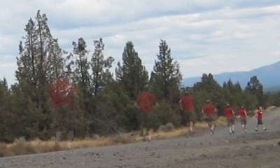
I then ate half of my sandwich, saving the other half for later, and started on my way. By the time I was about half a mile in, I was already hating walking on railroad ties. I across a couple bridges, and past many washed out areas.

All of this damage happened during a particularly bad storm about 3 years ago. This rail line has been closed since then, because the damage was too great for the owner (the Port of Tillamook) to repair.
The section I hiked, even with the massive damage, looks salvageable, but based on what I've read, that section is also the least damaged of the 16 mile long segment.

All along the path, the rails switch between sun and shade. Hiking through this canyon, though annoying on the railroad ties, is absolutely beautiful. Sheer cliff walls, a river steadily running downhill, and tons of trees (many changing color) and wildlife are the highlights.

After a couple of hours, I finally reach my destination, Enright.

Unfortunately for me, though, it is nowhere near what I expected. Yes, there is an old abandoned watering tower (for the railroad), but the rest of the so called "ghost town" is not what I would call a "ghost town".

Apparently my source and I differ in our definitions of what a ghost town is. When referring to a place in the middle of nowhere, I define a ghost town to be an abandoned town. One where no one lives anymore. Or at the very least, a town which has dozens of structures, and maybe only one occupied. My source apparently defines it as there being only two houses, both of which are obviously still occupied, and one even has smoke coming from the chimney! Both houses have very clear signs saying "No Trespassing", so I take a couple pictures of a house, one of the Enright sign, and I continue with my adventuring.

Parked on a siding right next to Enright, are at least a couple dozen abandoned rail cars for holding logs.

I take some pictures of them. I decide that my entire reason for wanting to camp tonight was to do so in a ghost town, so I decide to hike my way back out. I do so, taking many pictures on the way back, and doing some experimenting with the settings on my camera, so that I can see, once and for all, what things do. After returning to my car, I eat the rest of the sandwich, and drive myself back home. The total distance hiked was about 7 miles.
EDIT: Apparently my GPS unit's trip computer really sucks. According to the GPX tracklog, I hiked about 10 miles.
Lessons learned:
- If you are planning on camping overnight in a ghost town, make sure the town is actually ghostified before hiking multiple miles with gear.
- If buying bottled water for a hike, ensure that said water is not, in fact, carbonated. While it still hydrates you, it doesn't quench thirst quite so much.
- If you plan on hiking with your camping gear, make sure to have a backpack, not a duffel bag thrown over your shoulder.


8 vote(s)

teucer
4
Sombrero Guy
3
relet 裁判長
5
Not Here No More
5
Pixie
5
Samantha
3
Ty Ødin
4
Idøntity matrix
Favorite of:
Terms
(none yet)4 comment(s)

The rail line was open to hikers even before it was abandoned, so there were grates on all of the bridges. However, on some of them the grates had broken out, so I was very careful about stepping on any of them.

It's such a shame the place you took so much trouble to find wasn't the middle of nowhere.
But I love this, and all your pictures. What can I say? I'm a sucker for overgrown abandoned structures...
There is a total of 16 miles of abandoned rail here, and I intend to hike all of it one day. There are tunnels on some other parts, and the rest of it, as I mentioned, was much more damaged than the part I hiked. There's at least one section where half a mile of right of way was completely destroyed.
I too am a big fan of abandoned structures, which was one of the main reasons I wanted to see the ghost town.
Ha! The ghosts chased you away quite easily!
Lovely photos! Did you have to balance along these rail bridges, or was there usually a path around them?