


The Highest Place by praximity, artmouse, Monkey Hero
November 11th, 2008 8:35 PM / Location: 37.765252,-122.2434 -
-ⓜoustache ⓔnvy:
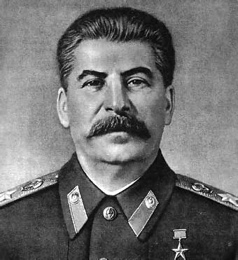
Alameda is an unassuming island located in the beautiful San Francisco Bay. It is approximately two miles wide and seven miles long, with a slight bend in the middle, making it almost moustache-like in shape, but sadly without curled ends. I would compare it to Stalin's moustache, though Alameda itself contains no real ridiculous political ambitions, they just coincide shape-wise.

The original geography of Alameda was that it was a small peninsula (off of what is now Oakland) composed of mostly marshy grasslands. In 1902 Alameda decided it didn't want to be connected to Oakland anymore, and "The Estuary" was born. The land they dug up to create our nifty tidal canal of course had to go somewhere, and ended up being distributed over the entire island, creating what is now our current elevation of a whole 8 feet above sea level!
In the spirit of everyday life itself so often being so anti-climactic, when I encountered the "highest place" task I was struck with the notion of finding the highest point in Alameda!!@!!one!!!1!!!!!11!!
Being so characteristically flat, even a lifelong resident of Alameda would be hard pressed to come up with the 'highest point' of Alameda (myself included). So, I set out in hopes of finding a proper topographic map of the island!
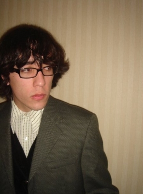
Mr. Edifice, who introduced me to the wonders of the Earth Sciences and Map Library, accompanied me to said library, where we employed some good ol' fashioned Teamwork to find exactly what we were looking for.


After having no luck in the 'bay area maps' section, we headed straight for what we thought would be the most fruitful section of all: California Topographic Quadrangles.

My first impulse was to check the 'Al' section as the maps were organized by city. After much combing of the 'Al' section, and subsequent checking and double checking of the surrounding folders ("Well maybe it got misfiled! What's in 'Am' and 'Ac'?). Unfortunately, living in Alameda has given me a disproportionately large perspective on how important Alameda actually is in relation to the rest of the state. Eventually we did find Alameda, sadly divided between two map quadrants of Oakland.

Upon inspection, it turned out there is no actual 'highest point' in Alameda - but rather a 'highest place' - an area spanning ~10 square blocks with an impressive elevation of 30 feet above sea level!

 Our objective: canvas the 'highest place' geographically of Alameda, CA and also find the HIGHEST POINT!
November 8th, 2008:
We set forth out into the drizzly day, further documented by the video and pictures below.
THE HIGHEST PLACE:
APPROACHING THE HIGHEST POINT:
ARRIVING AT THE HIGHEST POINT:
alameda.jpg

our photocopied segments
area in question

the area we were going to canvas - a close up of the maps digitally stitched together
waterproofing

our map, being made out of paper, needed a fancy plastic sleeve. this lame magazine was happy to oblige its extraneous wrapping.
folding to fit plasic sleeve

edifice getting meticulous

ready set.

it begins

longboard, bikes, map handy, we set off into the drizzly day
Edifice with Chainless Bike

approaching landmark #1

park st.

old-timey

Landmark #1

Our area to canvas began at Alameda City Hall, at the corner of Santa Clara & Oak
no wind whatsoever

Carnegie library across the street

onward

forward

i never quite realized how challenging it is to photo-document while riding a bicycle.
_

Landmark #2

Haight Elementary School

fancy church on corner

We take a left...

... and find ourselves in a labyrinth

-

travis, making his labyrinth face
-

_

we rode around in circles
_

_

_

obligatory artsy picture

_

one last look and off we go
consulting the map

now headed towards Central Ave.
bike route!

Yes

Alameda is very flat.
almost super flat

Encinal & Paru

while we were canvassing the area of 30 ft above sea level we arrived at the intersection of Encinal and Paru to discover that it actually appeared that all the surrounding directions of streets traveled downward from this point! (see video)
map check

Down Paru

panorama from the corner

we are here!

the highest geographical place!
!

a block down Encinal we found a real Mini! a lowest car at a highest place...
_

now traveling distinctly downhill (for Alameda, anyway) to our next objective: the highest *point* of Alameda
pulling in but not to park

*whoosh*

_

coming on to the roof of the parking structure, into the light
this is it

the top of a parking structure.
thumbs up

on the highest point of the parking structure
wow

Landmark #1

city hall & carnegie library from bird's eye
walking the line

east facing

_

_

it was indeed rather high

_

over the edge

peering off into the distance

_

next stop... the infinite beyonddd

police.jpg

a cop pulled into the parking garage, so we made our exit
_

hehehe

lunch beckoned

adventuring sure does make the stomach growl, so we stopped by the produce stand
yum

herbed goat cheese, smoked salmon, fresh greens & a baguette
cuba!

an herbal energy drink named after a socialist republic whose motto is 'Homeland or Death'
riding by

what's showing

wow, showing Zach & Miri? ballsy! Alameda is known for its super family oriented spirits
Lunch is Served!

18 vote(s)

susy derkins
4
Augustus deCorbeau
3
Mr Everyday
5
Myrna Minx
3
saille is planting praxis
4
Anaximander Holywell
3
zer0gee
5
Lincøln
3
Amoeba Man
3
Loki
5
Soren THREEdux
5
Ben Yamiin
5
Waldo Cheerio
4
Lank
3
Hortvald Inki
2
Spidere
4
Not Here No More
5
gh◌st ᵰⱥ₥ing
Terms
shplank, bicycle, map, mapping9 comment(s)

you can be assured it was nothing short of absolutely delicious

I really like the picture of the rolled-up maps with the tags hanging down!

and i really like that library.
i could have touched all of those things.
maybe i even did.


I like the idea of finding the highest point in a flat place.


Beautiful execution. Great racks of maps, photography standing on the highest point of the tallest building, you can't do it better. I still want to see it done in other, more physically challenging ways, but the way you did it is flawless. I call a shplank.

You guys always be hard-rockin' it.
Also, the Stalin-moustache-business.
Also, I shaved mine.
"Ah, yeah, we found a labyrinth. But we had LUNCH!". Um, ok.