Mapping in Minute Precision by Lank
April 4th, 2008 9:03 PM / Location: 37.766245,-122.4480I guess what threw me was that the links in the task (and comments thereto) brought up things that I would not have otherwise recognized as maps. I thought it would be easy - too easy - to just make a Google map with markers for each point in time that I recorded, and that wasn't nearly as creative as the I believed Senator Unit intended for us to get when he hallucinated this task.
So, even though I've been going BartPA-heavy recently, I decided to chew on some of my UofA roots and re-think the idea of "map".
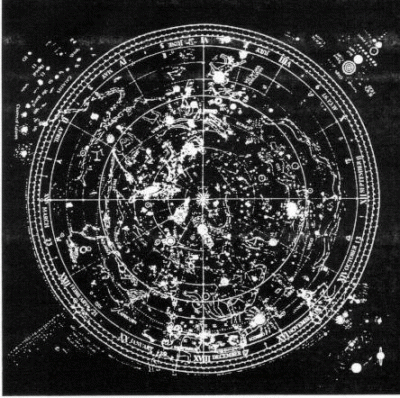
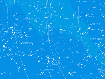
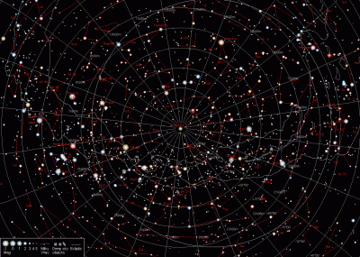
The important element of this task is time. Each point in time recorded is just that - a point in physical space. Certainly some of these points would overlap. As I was meditating on the idea of physically manifesting points in time in physical space, I thought about stars. Stars are points of light that represent a time long, long ago - millions of years ago, even. And from where we are, the stars are relatively fixed and can be read... like a map! So I thought about celestial maps I had seen:
 "Create a map that contains only these data." With that in mind, I decided to dis-associate the surroundings of the temporal locations I recorded and map them like stars in the heavens, with nothing but space between them. And when multiple times overlapped in physical space, those would be larger stars. I love looking up at the night sky and trying to fathom the depth of the universe. It's neat to know that two stars which appear to be right next to each other to my eye may actually be many light years apart - I just can't see the depth that separates them. Similarly, my map contains points that are very close together, but separated by time. In this instance, time is the invisible third dimension.
Then I had to figure out what kind of key or legend my map would use to indicate the time associated with each point. Here I decided to be inspired by the pattern of a circular clock, as well as the circular old-timey maps of the celestial sphere. I liked the idea of visually noting the sequential order of my whereabouts and thought it would be easier to note these by being able to access the points from all sides.
I chose a 36 hour period during which I knew I would be active. Otherwise, there wouldn't be much data to work with. And I decided to mark every 50 minutes into the hour, because 10 'til is a popular time to be going somewhere.
This is the map I ended up with, drawn on black construction paper with silver pen:

It's all within an approximately four mile stretch of San Francisco. Each point represents my physical location at a specific time. The dotted lines connect each point to it's corresponding time. For points at which I was present for stretches of time, of which there are three, I assigned astrological symbols. For my home, I used a symbol for Earth, for work, the symbol for Saturn, and for our friend's house where we drank late into Sunday night, the symbol for Jupiter.
After uploading the scan of this map, I added the exact latitude and longitude of these three locations in the bottom right, so that one may triangulate on a mundane map the locations to which each of the points corresponds.
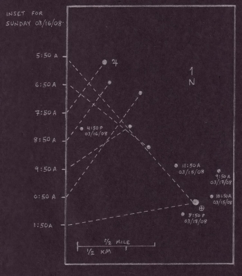
I was displeased by how jumbled much of the information is in the lower left section of the map (where the box is). But since it was such a pain in the ass to draw the thing by hand with silver markers, I didn't want to re-do the whole thing. So I made an insert for the section of time to which most of those points correspond (Sunday morning), and drew that on the back:

I think the map looks better without all of the lines, it just doesn't correlate the time info:

With this view, I'm very tempted to draw new lines between the points and create constellations, but I'll leave that to your imaginations...
The Map
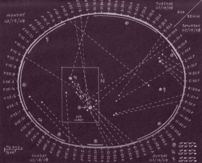
With all info (the latitude/longitude digits in the bottom right were added in via Photoshop after I'd made the map by hand)
Map sans Lines
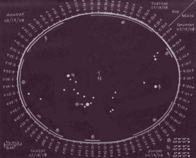
This one gives a better view of the individual points, and thereby looks more like stars.
First Draft
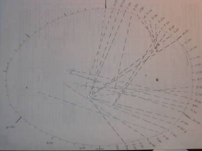
This was my practice run at drawing the map. It's only half-done, and as you can see, quite different.
Tools
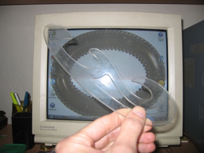
anna one lent me this cool drafting tool to draw an oval, but since I didn't know how to use it, I downloaded an oval shape, put it on my desktop, and traced it.
24 vote(s)

Sparrows Fall
5
Lincøln
5
susy derkins
5
Jellybean of Thark
5
Loki
5
Stu
5
Haberley Mead
5
Optical Dave
5
Tøm
5
Burn Unit
5
anna one
5
Adam
5
GYØ Ben
5
Soren THREEdux
5
Myrna Minx
5
JTony Loves Brains
5
teh Lolbrarian
5
Secret Agent
5
Dela Dejavoo
5
meredithian
5
kara boyer
5
Kassitastrophe
5
Scarlett
5
Evil Sugar
Favorite of:
Terms
(none yet)14 comment(s)
Sequential events going along a slinky-like spiral. Draw-by-numbers, but when seen from where? From outside, you lose the depth.
I like the notion that the most time you spend in a certain place, the shinier it becomes.
Maps beyond maps, only at SF0.
Hooray for new and weird forms of data visualization.
I like the observation that 10 'til is a time when people are going somewhere. Very nice completion.
Why I was smoking that bag of crack rocks I gave to that guy on the train!
Okay. I was really doing my SFZEROSAT
I really love data visualization and am a great fan of Tufte (for example) and one of my favorite things is looking at those amazing charts and tables and discovering on my own their meaning--because they're constructed to invite my discoveries and participation. This very much meets that criterion, data that tells you about itself in its own language.
I knew I probably wouldn't be able to get that doing it myself most of the time, so I figured I could turn it over to SF0 and get a steady dose. Thanks for the fix, man.
Seriously, I love this map, and like Senator Burn Unit says, figuring out the way to read it is half the fun. I sat there just staring at it for quite some time before I figured out what was going on. Why the location symbols were on the map more than once, why some times on the sides had the long lines next to them, and why some times had no dotted lines going to places. It was seriously a lot of fun figuring it out.
Strong work my friend, strong work.
I'm so glad I had you handy right here to explain this to me.
You're welcome.
Anyone else need me handy right there?
You can have a vote because you admit that the task as written is mind-numbing. And you attempted to do something vaguely interesting with a bunch of data of no possible interest to anyone :>
I'm interested!
If I could I'd follow Lank around like a puppy for a whole week, just collecting that data.







Vote for use of astrological symbols!