


Tasks / Strip Map

Create a strip map modeled on Ogilby's maps.
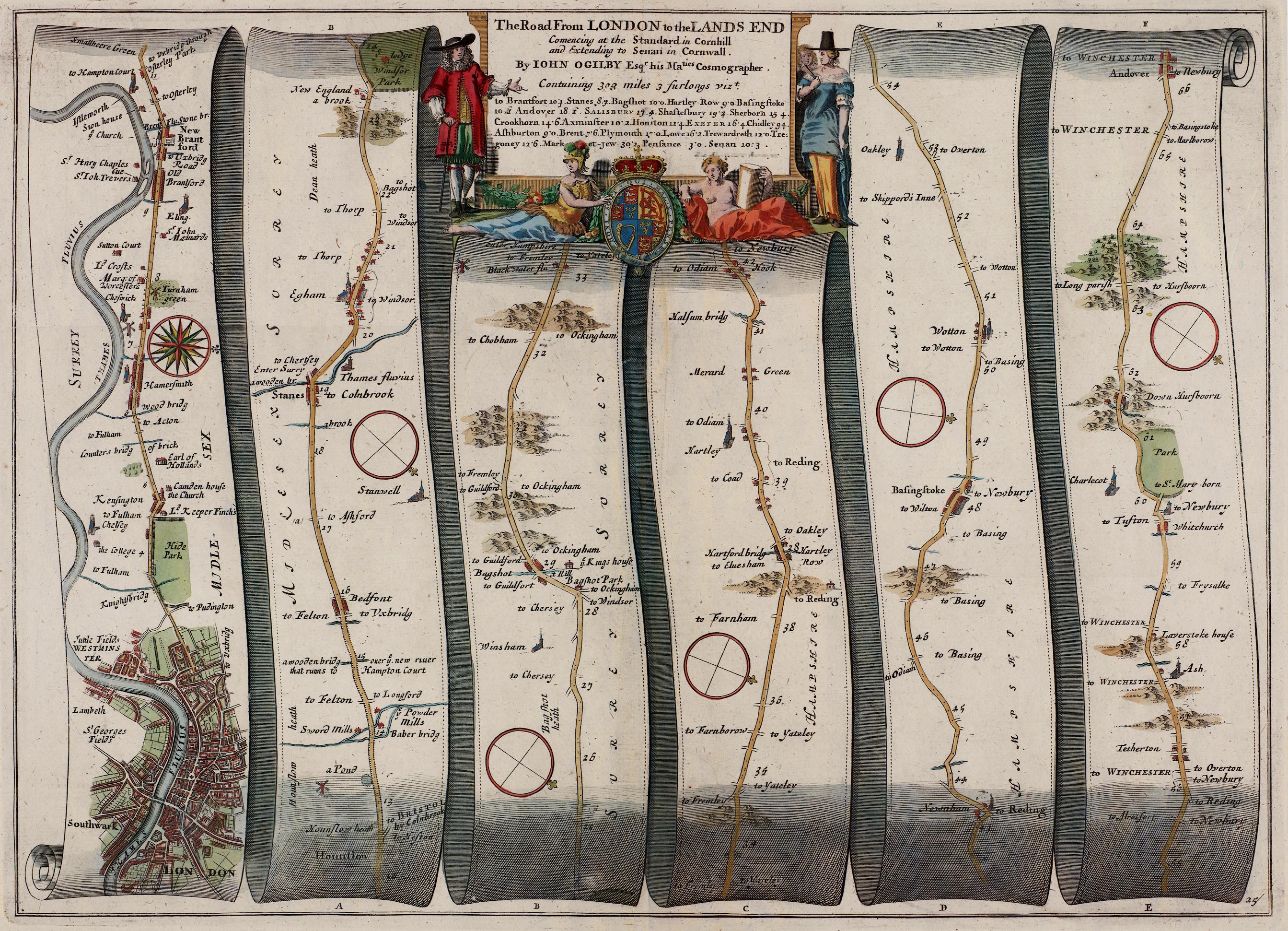
"A strip map is a process map, a diagram of how to go from one place to another; route and destinations are predetermined. Ordinary maps are state maps describing the whole countryside; the user decides where to go from wherever he is."
Your map should provide an intimate description of what might be seen on a journey, from a slow moving vehicle or on foot.
Be sure to examine the example image below.
1 to 5 players
45 points
Level 3
Requires BART Psychogeographical Association OR The University of Aesthematics
4 completed :: 4 in progress
Interested in collaborating on this: (no one yet!)
this task is retired
Comments
Praxis
view all images for: Strip Map


This is a strip map of O'Farrel Street. It begins at Van Ness and ends at Powell. I am a very visual person. This map is intended to be 10 inches by 150 inches. Try and walk down my neighborhood block and find all of these things!

here ya go, telegraph ave. in berkeley, calif. this is the first installation (of 3) before it's completed. people do that, right? originally i hand drafted "from end to end" meaning all the way to downtown oakland, but since i decided to...

I created a strip map of the Central Avenue/3rd Avenue/Highway 65 bridge over the Mississippi River in Minneapolis. I'm particularly fond of the river bridges of Minneapolis. This one is right in the heart of the city, affording wonderful views. Peop...

This strip map is a loop around my neighborhood, and as I walked around, I looked for things that I might not notice otherwise along the way. Things that would be landmarks for another who might travel the same route. Note that this map does not co...
interested in collab work with other locals; reach out if so inclined.